Europe_and_the_Near_East_at_476_AD.png

Size of this preview:
800 × 556 pixels
.
Other resolutions:
320 × 222 pixels
|
640 × 445 pixels
|
1,024 × 712 pixels
|
1,280 × 890 pixels
|
2,830 × 1,967 pixels
.

|
This
historical map
image could be re-created
using
vector graphics
as an
SVG
file
. This has several advantages; see
Commons:Media for cleanup
for more information. If an SVG form of this image is available, please upload it and afterwards replace this template with
{{

vector version available

|

new image name

}}
.
It is recommended to name the SVG file “Europe and the Near East at 476 AD.svg”—then the template Vector version available (or Vva ) does not need the new image name parameter. |
Summary
| Description |
English:
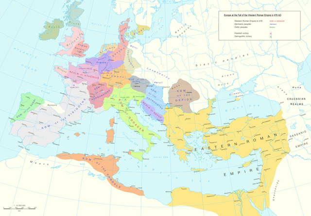
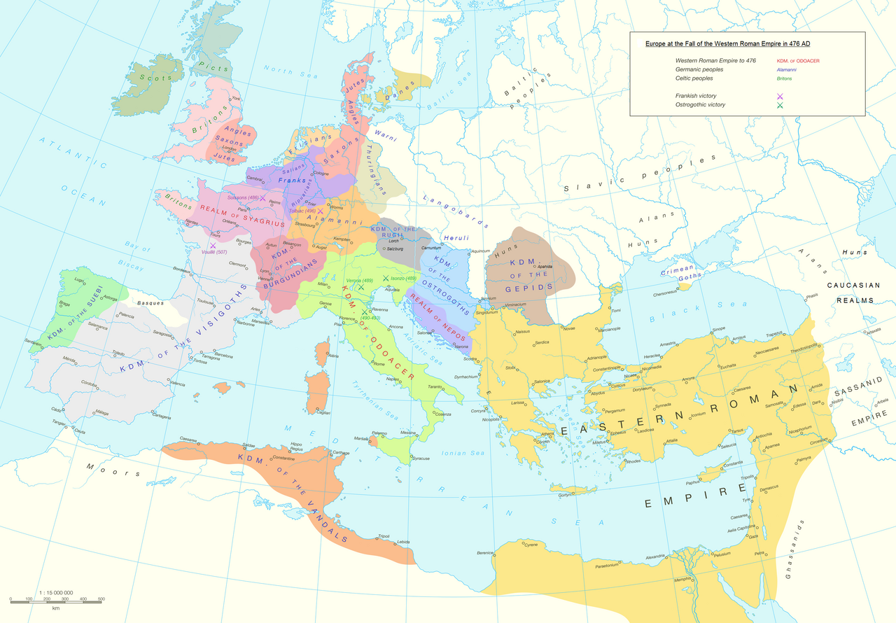
Political division in Europe, North Africa and Near East after the end of the Western Roman Empire in 476 AD. Romance area added since H. M. Glessegen (dir.),
Handbuch der Romanische Sprachgeschichte
, Berlin/New York, p. 544-555. Modified Gaëls / Picts / Britons (see discussion file).
Español:
Mapa político de Europa, el Norte de África y Oriente Próximo tras el fin del Imperio Romano de Occidente en 476 d.C. Área románica añadida desde H. M. Glessegen (dir.),
Handbuch der Romanische Sprachgeschichte
, Berlín/Nueva York, p. 544-555. Gaëls / Pictos / Británicos modificados (ver archivo de discusión).
Français :
L'Europe, l'Afrique du Nord et le Proche-Orient après la fin de l'Empire romain d'Occident en 476. Limites des langues romanes ajoutées d'après H. M. Glessegen (dir.),
Handbuch der Romanische Sprachgeschichte
, Berlin/New York, p. 544-555. Modifié les Gaëls / Pictes / Bretons d'après la page de discussion.
|
| Date | |
| Source | Putzger Historischer Weltatlas , Cornelsen, Berlin 1992 ISBN 3-464-00176-8 , pp. 34-35 (maps by R. Hachmann). |
| Author | Guriezous |
|
Permission
( Reusing this file ) |
Own work |
Licensing
I, the copyright holder of this work, hereby publish it under the following license:
This file is licensed under the
Creative Commons
Attribution-Share Alike 4.0 International
license.
-
You are free:
- to share – to copy, distribute and transmit the work
- to remix – to adapt the work
-
Under the following conditions:
- attribution – You must give appropriate credit, provide a link to the license, and indicate if changes were made. You may do so in any reasonable manner, but not in any way that suggests the licensor endorses you or your use.
- share alike – If you remix, transform, or build upon the material, you must distribute your contributions under the same or compatible license as the original.