Cisleithania,_Lands_of_the_Crown_of_Saint_Stephen,_Bosnia_and_Herzegovina.svg

Size of this PNG preview of this SVG file:
776 × 600 pixels
.
Other resolutions:
311 × 240 pixels
|
621 × 480 pixels
|
994 × 768 pixels
|
1,280 × 989 pixels
|
2,560 × 1,978 pixels
|
783 × 605 pixels
.
Summary
| Description |
English:
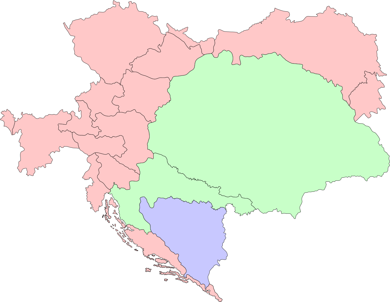
The map shows administrative division of
Austria-Hungary
.
Cisleithania
, governed by Austria, is shown in red; the
Lands of the Crown of Saint Stephen
, governed by Hungary, are shown in green; the
Condominium of Bosnia and Herzegovina
, which was governed by both, Austria and Hungary, is shown in blue.
|
| Date | |
| Source | Own work |
| Author | Herr Ziffer |
Licensing
I, the copyright holder of this work, hereby publish it under the following licenses:
This file is licensed under the
Creative Commons
Attribution-Share Alike 3.0 Unported
license.
-
You are free:
- to share – to copy, distribute and transmit the work
- to remix – to adapt the work
-
Under the following conditions:
- attribution – You must give appropriate credit, provide a link to the license, and indicate if changes were made. You may do so in any reasonable manner, but not in any way that suggests the licensor endorses you or your use.
- share alike – If you remix, transform, or build upon the material, you must distribute your contributions under the same or compatible license as the original.

|
Permission is granted to copy, distribute and/or modify this document under the terms of the GNU Free Documentation License , Version 1.2 or any later version published by the Free Software Foundation ; with no Invariant Sections, no Front-Cover Texts, and no Back-Cover Texts. A copy of the license is included in the section entitled GNU Free Documentation License . |
You may select the license of your choice.