Carlisle_pupils.jpg
No higher resolution available.
Summary
|
|
This is an image of a place or building that is listed on the
National Register of Historic Places
in the
United States of America
. Its reference number is
66000658
.
|
| Description |
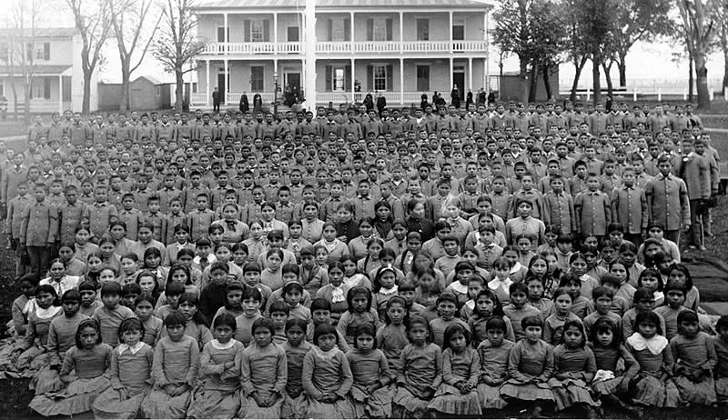
English:
Pupils at
Carlisle Native Industrial School
,
Pennsylvania
(c. 1900).
Source:
Frontier Forts
|
| Source | Unknown source |
| Author | Unknown author |
| Object location |
|
View this and other nearby images on: OpenStreetMap |
|
|---|
Licensing
|
|
This media file is in the
public domain
in the
United States
. This applies to U.S. works where the copyright has expired, often because its first
publication
occurred prior to January 1, 1929, and if not then due to lack of notice or renewal. See
this page
for further explanation.
|

|

|
This image might not be in the public domain outside of the United States; this especially applies in the countries and areas that do not apply the
rule of the shorter term
for US works, such as Canada, Mainland China (not Hong Kong or Macao), Germany, Mexico, and Switzerland. The creator and year of publication are essential information and must be provided. See
Wikipedia:Public domain
and
Wikipedia:Copyrights
for more details.
|
Original upload log
The original description page was
here
. All following user names refer to en.wikipedia.
- 2006-07-12 21:28 Phaedriel 800×462 (106457 bytes) Pupils at [[Carlisle Indian school]], [[Pennsylvania]] (c. 1900) ''Source: [http://www.texasbeyondhistory.net/forts/images/carlisle.html Frontier Forts]