2008_age_of_ocean_plates.png

Size of this preview:
800 × 421 pixels
.
Other resolutions:
320 × 168 pixels
|
640 × 337 pixels
|
1,024 × 538 pixels
|
1,280 × 673 pixels
|
2,560 × 1,346 pixels
.
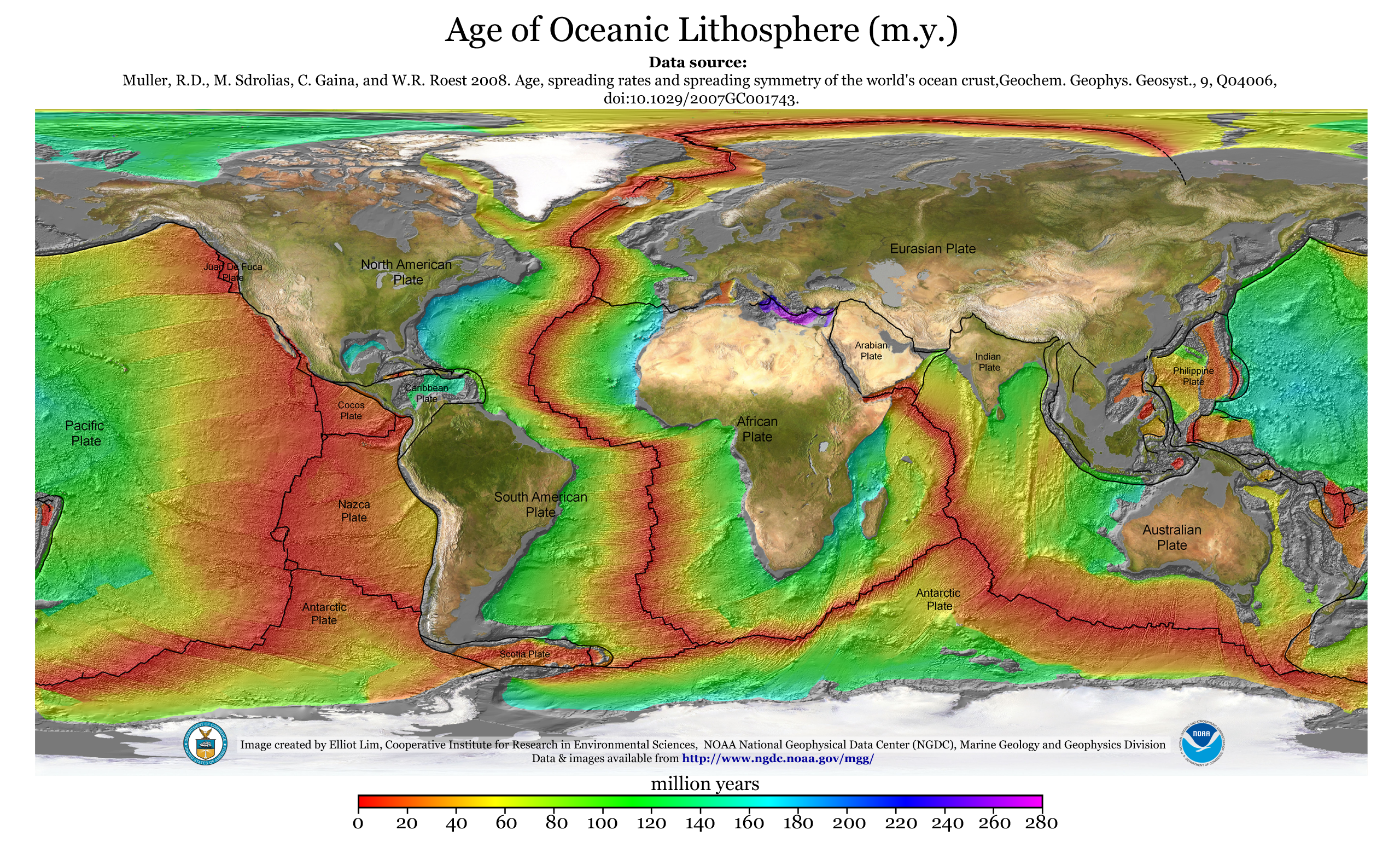
Summary
| Description |
English:
A map of the age of oceanic lithosphere
|
| Date | |
| Source | http://www.ngdc.noaa.gov/mgg/ocean_age/data/2008/ngdc-generated_images/whole_world/2008_age_of_oceans_plates.png |
| Author | Elliot Lim, CIRES & NOAA/NGDC |
Data source: Muller, R. D., M. Sdrolias, C. Gaina, and W. R. Roest 2008. Age, spreading rates and spreading symmetry of the world's ocean crust, Geochem. Geophys. Geosyst. 9, Q04006, doi:10.1029/2007GC001743.
Licensing
|
|
This image is in the
public domain
because it contains materials that originally came from the U.S.
National Oceanic and Atmospheric Administration
, taken or made as part of an employee's official duties.
|
|